Dredge Pile Raster Extract by Mask and others
When using raster data and digital surface models, one can often use many different tools to interpret elevation, slope, and aspect numbers as potential threats to operation or progress being made at a site. For this example I am using a dredging site located in Eau Claire Wisconsin to view many different features that these dsm models can show us.
Over three dates, photos were compiled of this dredging operation, and a dsm was created for each dates so further analysis could be done. Using the extract by mask tool, one can minimize the area of interest as it pertains to a certain elevation, slope, or other value being measured over time.
Once, extracted, the model must be resampled in a bilinear manner (by calculating the value of the pixel by averaging the values of the four surrounding pixels) because it is a continuous land feature.
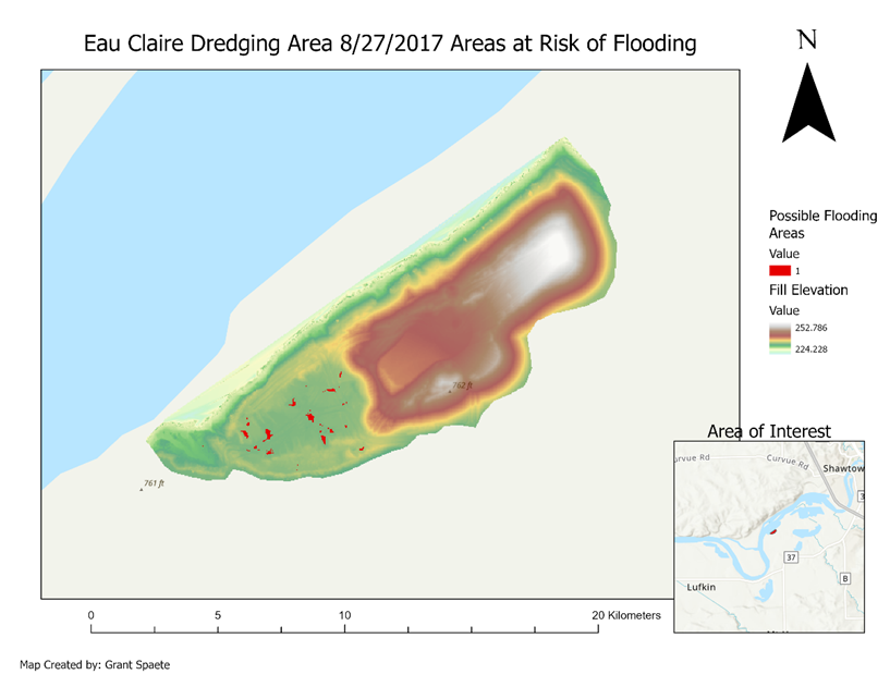
Next to further show the capabilities of a map calculator within a resampled and extracted dsm, values of elevation between 233 and 234m were found

Another map made later is one from data collected at PWA just a few weeks ago. Here the hillshade tool was applied to the dsm, and set to a high transparency. Then the elevation location of features greater than 10m was found.

Notice the features that appear in dark red are mainly trees on the bottom left and a strip of pines and power lines on the right side of the map.
Slopes can also be found. Below is a representation of slope features that are greater than 30 degrees at the dredging site, filled in with black to stand out.

Progress in the dredging can also be viewed as one can see the differences in between dates during the excavation using shaded dsm models on a black and white grayscale.


From July 4th to July 22nd little movement and progress has been made. However when comparing with the second map from the 22nd of July to August 27nd, substantial earth has been moved within the dredging site.
Using dsms to monitor change only works if consistent and interval timing is used and parameters remain the same during capturing and post processing.


Comments
Post a Comment